AUSTIN US
AUSTIN
HomeGeophysicsResistividad eléctrica / SEV (sondeo vertical)

Electrical Resistivity / VES for Geotechnical Surveys in Austin

Rigorous testing. Clear reporting.

LEARN MORE

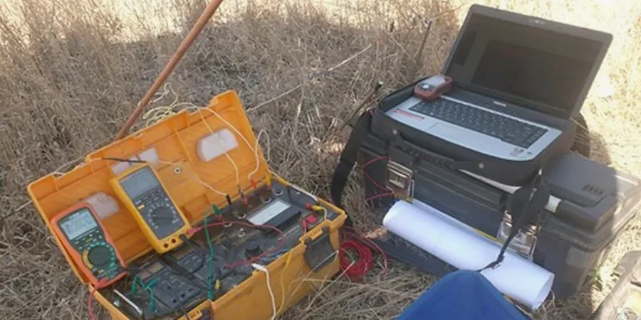
Soil conditions shift dramatically across Austin. In the western hills near Barton Creek, limestone bedrock often sits less than 3 meters deep, while east of I-35 the Colorado River floodplain deposits silty clays and sands extending 20 meters or more. That contrast makes it impossible to rely on a single geotechnical model for the whole city. Electrical resistivity and VES surveys let us map those transitions non-invasively, identifying buried channels, perched water tables, and weathered rock boundaries before we even mobilize a drill rig. We routinely combine this geophysical data with a targeted ensayo SPT program to calibrate resistivity profiles against direct penetration resistance.

Illustrative image of Electrical resistivity / VES (Vertical Electrical Sounding) in Austin
A single VES line can detect a buried channel or karst cavity that would take five boreholes to find with the same confidence.

Our service areas

Process overview

Austin sits atop the Balcones Fault Zone, a structural transition where Cretaceous limestone and marl dip eastward beneath alluvial terrace deposits. The resistivity contrast between competent limestone (typically 500-2000 ohm-m), clay-rich marl (20-80 ohm-m), and saturated sand (50-150 ohm-m) makes VES highly effective for profiling. We deploy Schlumberger arrays with electrode spacings up to 100 meters to resolve layers down to 25-30 meters depth. Data inversion uses a least-squares smooth model constrained by known borehole logs from nearby projects. For shallow investigations under 8 meters, we pair VES with georradar GPR to capture finer resolution on cavity detection and fracture zones in the Edwards Aquifer recharge zone.
Technical reference — Austin

Local context

A 10-story student housing project near the intersection of Guadalupe and MLK encountered a buried paleochannel filled with loose sand that was invisible in the preliminary borings. The VES survey, conducted after foundation piles began refusing prematurely, revealed a 12-meter-wide conductive anomaly at 8 meters depth. We correlated that with CPT soundings and found the sand unit had blow counts below N=4. The owner had to redesign the pile layout and add a Improvement program using stone columns. The cost of the resistivity survey was roughly 0.3% of the change order. That kind of scenario plays out in Austin whenever fill, alluvium, or weathered limestone is assumed uniform without geophysical verification.

Need a geotechnical assessment?

Reply within 24h.

Email: contact@geotechnicalengineering1.com

Relevant standards


ASTM D6431-18 (Standard Guide for Using the Direct Current Resistivity Method), ASTM G57-06(2012) (Field Measurement of Soil Resistivity), ASCE 7-16 (Site classification based on vs30/" data-interlink="1">shear wave velocity — VES correlates Vs via resistivity)

Technical data

ParameterTypical value
Array configurationSchlumberger (standard), Wenner (for horizontal layering)
Maximum electrode spacing100 m (AB/2 up to 50 m)
Depth of investigationTypically 25-30 m; up to 50 m with extended lines
Resistivity range resolved1 - 5000 ohm-m
Inversion softwareRes2Dinv / IPI2Win (smooth model + solid)
Field crew size2 technicians + 1 geophysicist

FAQ


How deep can a VES survey reach in Austin soils?

With a 100-meter Schlumberger array, we typically achieve 25-30 meters of depth penetration in the Austin area. In high-resistivity limestone the signal-to-noise ratio extends to about 50 meters. For deeper targets we recommend combining VES with MASW or microtremor surveys.

What is the typical cost range for an electrical resistivity survey in Austin?

A standard VES survey with 5 soundings and 2D inversion costs between US$720 and US$1,030, depending on site access, line length, and reporting detail. Multi-line ERT profiles for linear projects run higher due to increased field time and electrode deployment.

Can resistivity surveys detect groundwater in the Edwards Aquifer recharge zone?

Yes, but with limitations. Saturated limestone formations show resistivity values below 100 ohm-m, while dry limestone exceeds 500 ohm-m. VES can identify the depth to the water table in weathered zones, but direct hydraulic testing is needed for permeability estimates. We always correlate VES with nearby well logs.

How does VES compare to test pits for bedrock depth mapping?

VES covers much more ground — a single profile line replaces 10-15 test pits in terms of spatial resolution. However, test pits provide direct visual observation and undisturbed samples. We recommend VES as a screening tool before test pits, especially in environmentally sensitive areas where excavation is restricted.

Location and service area

We serve projects across Austin.

Location and service area